Klang (Klang)
 |
The Klang Municipal Council or MP Klang exercises jurisdiction for a majority of the Klang District while the Shah Alam City Council exercises some jurisdiction over the east of Klang District, north of Petaling District and the other parts of Selangor State including Shah Alam itself.
As of 2010, the Klang City has a total population of 240,016 (10,445 in the city centre), while the population of Klang District is 842,146, and the population of all towns managed by Klang Municipal Council is 744,062, making it Selangor's second largest city.
The royal town of Klang has been a site of human settlement since prehistoric times. Bronze Age drums, axes and other artefacts have been found in the vicinity of the town and within the town itself. A bronze bell dating from the 2nd century BC was found in Klang and is now in the British Museum. Also found in or near Klang are iron tools called "tulang mawas" ("ape bones") and a bronze drum. Commanding the approaches to the tin rich Klang Valley, Klang has always been of key strategic importance. It was mentioned as a dependency of other states as early as the 11th century. Klang was also mentioned in the 14th century literary work Nagarakretagama dated to the Majapahit Empire, and the Klang River was marked and named on the earliest maritime charts of Chinese Admiral Cheng Ho who visited Malacca from 1409 to 1433.
Klang was under the control of the Malacca Sultanate in the 15th century. The celebrated Tun Perak, the Malacca's greatest Bendahara, came from Klang and became its territorial chief. According to the Malay Annals, the people of Klang overthrew the local chief or penghulu and asked the Sultan of Malacca Muzaffar Shah to appoint another, and Tun Perak was then appointed the leader. Klang was known as a producer of tin; according to Manuel Godinho de Erédia, it produced one hundred bares of tin a year when the Portuguese occupied Malacca. Klang however remained in Malay hands after the fall of Melaka to the Portuguese in 1511, and was controlled by the Sultan of Johor-Riau. In the 17th century, the Bugis began to settle in the coastal region of Selangor including Klang, and the Selangor sultanate was created in the 1766, which then controlled Klang.
In the 19th century the importance of Klang greatly increased by the rapid expansion of tin mining as a result of the increased demand for tin from the West. The desire to control the Klang Valley led directly to the Klang War (also called the Selangor Civil War) of 1867–1874 when Raja Mahdi fought to regain what he considered his birthright as territorial chief against Raja Abdullah. During the Klang War, in 1868, the seat of power was moved to Bandar Temasya, Kuala Langat, and then to Jugra which became the royal capital of Selangor.
Klang however did not lose its importance. In 1874, Selangor accepted a British Resident who would "advise" the Sultan, and Klang became the capital of British colonial administration for Selangor from 1875 until 1880 when the capital city was moved to Kuala Lumpur due to the growth of Kuala Lumpur from tin-mining. Today Klang is no longer State capital or the main seat of the ruler, but it remains the headquarters of the District to which it gives it name.
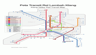
Until the construction of Port Swettenham (now known as Port Klang) in 1901, Klang remained the chief outlet for Selangor's tin, and its position was enhanced by the completion of the Klang Valley railway to Bukit Kuda in 1886, which was then connected to Klang itself via a rail bridge, the Connaught Bridge, completed in 1890. In the 1890s its growth was further stimulated by the development of the district into the State' leading producer of coffee, and later rubber. In 1903, the royal seat was moved back to Klang when it became the official seat of Sultan Sulaiman (Sultan Alauddin Sulaiman Shah).
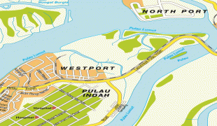
In May 1890, a local authority, known as Klang Health Board, was established to administer Klang town. The official boundary of Klang was first defined in 1895. The first road bridge over the Klang River connecting the two parts of the town, the Belfield Bridge, was constructed in 1908. In 1926 the health boards of Klang and Port Swettenham were merged, and in 1945 the local authority was renamed Klang Town Board. In 1954, the Town Board became the Klang Town Council after a local election was set up to select its members in accordance with the Local Government Election Ordinance of 1950. In 1963, the Port Klang Authority was created and it now administers three Port Klang areas: Northport, Southpoint, and West Port.
In 1971, the Klang District Council, which incorporated the nearby townships of Kapar and Meru as well as Port Klang, was formed. After undergoing a further reorganisation according to the Local Government Act of 1976 (Act 171), Klang District Council was upgraded to Klang Municipal Council (KMC) on 1 January 1977. From 1974 to 1977, Klang was the state capital of Selangor before the seat of government shifted to Shah Alam in 1977.
Map - Klang (Klang)
Map


Country - Malaysia
 |
 |
| Flag of Malaysia | |
Malaysia has its origins in the Malay kingdoms, which, from the 18th century on, became subject to the British Empire, along with the British Straits Settlements protectorate. Peninsular Malaysia was unified as the Malayan Union in 1946. Malaya was restructured as the Federation of Malaya in 1948 and achieved independence on 31 August 1957. The independent Malaya united with the then British crown colonies of North Borneo, Sarawak, and Singapore on 16 September 1963 to become Malaysia. In August 1965, Singapore was expelled from the federation and became a separate independent country.
Currency / Language
| ISO | Currency | Symbol | Significant figures |
|---|---|---|---|
| MYR | Malaysian ringgit | RM | 2 |
| ISO | Language |
|---|---|
| ZH | Chinese language |
| EN | English language |
| MS | Malay language |
| ML | Malayalam language |
| PA | Panjabi language |
| TA | Tamil language |
| TE | Telugu language |
| TH | Thai language |